How to Read a Nautical Chart: Symbols, Depths, and Navigation Markers Explained
Learning how to read a nautical chart is an essential skill for anyone interested in sailing, boating, or exploring coastal waters. Unlike traditional road maps, nautical charts provide detailed information about water depths, underwater hazards, navigation markers, and coastal features that help boaters travel safely. Understanding these details allows sailors to plan routes, avoid dangerous conditions, and navigate unfamiliar waterways with greater confidence.
Whether you’re preparing for your first sailing adventure or looking to strengthen your navigation skills, knowing how to read nautical charts can make a significant difference in your safety on the water. This beginner’s guide explains the most important chart symbols, depth measurements, navigation markers, and practical techniques every aspiring sailor should understand.
What Is a Nautical Chart and Why Is It Important?
A nautical chart is a specialized maritime map designed to help boaters navigate oceans, coastal waters, harbors, and inland waterways. These charts contain detailed information about the surrounding marine environment, including water depths, shoreline characteristics, navigational hazards, and aids to navigation.
Unlike conventional maps that primarily emphasize roads and landmarks, nautical charts focus on the conditions above and below the water’s surface.
Some of the most important information found on a nautical chart includes:
- Water depths: Measurements that help boaters identify shallow areas and avoid running aground.
- Coastlines and land features: Shoreline details, islands, and recognizable landmarks that assist with positioning.
- Navigation markers: Buoys, beacons, and lights that identify channels, hazards, and navigational routes.
- Underwater hazards: Rocks, shipwrecks, reefs, and other obstructions that could damage a vessel.
- Anchorage areas: Designated or charted locations where vessels may be able to anchor, subject to local restrictions and conditions.
- Latitude and longitude: Geographic coordinates used to determine a vessel’s position and plot courses.
Understanding these features is particularly important when navigating unfamiliar coastal areas, where changing depths, currents, and underwater obstacles can create unexpected challenges.
How to Read a Nautical Chart: Understanding the Basic Elements
Before learning how to interpret specific symbols and navigation markers, it’s important to become familiar with the basic layout of a nautical chart. Every chart contains essential reference information that helps sailors understand distances, directions, and the surrounding environment.
1. Chart Scale and Distance Measurements
A nautical chart’s scale indicates the relationship between distances shown on the chart and actual distances on the water.
For example, a chart with a scale of 1:40,000 means that one unit of measurement on the chart represents 40,000 of those same units in the real world.
Larger-scale charts show smaller geographic areas in greater detail, making them particularly useful when entering harbors or navigating narrow channels. Smaller-scale charts cover broader areas and are more suitable for planning longer coastal passages.
Nautical charts also use nautical miles to measure distance. One nautical mile equals approximately 1.15 statute miles, and one minute of latitude corresponds to one nautical mile.
When measuring distance on a traditional nautical chart, sailors generally use the latitude scale along the chart’s side at approximately the same latitude as the route being measured.
2. Latitude and Longitude Coordinates
Latitude and longitude form the geographic coordinate system used to identify specific positions on Earth.
- Latitude: Measures how far north or south a location is from the equator.
- Longitude: Measures how far east or west a location is from the prime meridian.
These coordinates allow sailors to identify their current position, locate destinations, and plot navigational waypoints.
For example, a GPS receiver may display a vessel’s position using degrees and decimal minutes of latitude and longitude. That information can be plotted on a compatible nautical chart to help confirm the vessel’s location.
3. Compass Roses and Directional Bearings
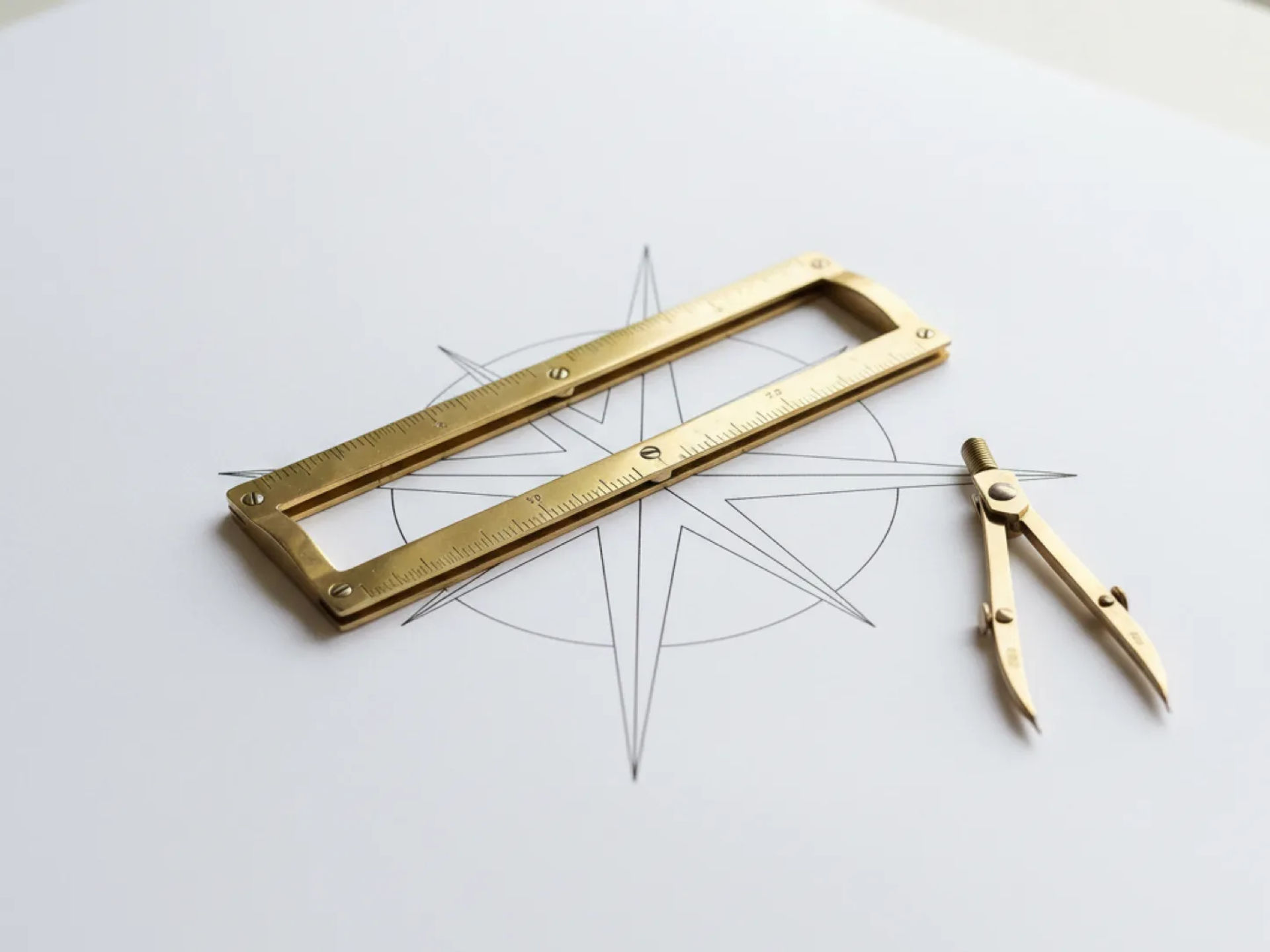
A compass rose is a circular diagram printed on traditional nautical charts that helps sailors determine direction.
Most compass roses include references for true north and magnetic north, allowing navigators to account for magnetic variation when converting between true and magnetic bearings.
Understanding the compass rose is essential when plotting courses, identifying landmarks, and determining which direction a vessel should travel.
How to Read Nautical Chart Symbols and Abbreviations
One of the most important aspects of learning how to read nautical charts is understanding the symbols used to represent maritime features.
Nautical charts rely on standardized symbols and abbreviations to communicate large amounts of information without overcrowding the map.
Some common categories of nautical chart symbols include:

Rocks, Reefs, and Underwater Obstructions
Rocks, reefs, shipwrecks, and other underwater hazards are represented by specialized symbols that indicate their location and, in some cases, their depth or whether they uncover at low tide.
These symbols are particularly important when navigating close to shore or traveling through shallow coastal waters. Sailors should always review potential hazards before plotting a route.
Anchoring and Mooring Areas
Anchor symbols are commonly used to identify anchorage areas or related facilities. However, the exact meaning depends on the symbol and accompanying chart information.
Some locations may have restrictions related to vessel size, environmental protection, or permissible anchoring activities.
Seabed Characteristics
Nautical charts may also use abbreviations to describe the composition of the seafloor.
Common examples include:
- S: Sand
- M: Mud
- R: Rock
- Sh: Shells
- Cy: Clay
These details can be useful when choosing an anchoring location because different seabed materials affect how well an anchor may hold.
Lighthouses and Navigational Lights
Lighthouses, lighted buoys, and illuminated beacons are represented by symbols and abbreviations describing their characteristics.
For example, a light marked "Fl G 4s" indicates a flashing green light with a four-second period.
Recognizing light characteristics helps sailors identify specific navigation aids, particularly when operating after sunset or during reduced visibility.
For a comprehensive explanation of maritime symbols, NOAA provides U.S. Chart No. 1, a reference guide covering nautical chart symbols, abbreviations, and terminology.
Understanding Water Depths and Contour Lines on Nautical Charts
Water depth is one of the most critical elements of nautical navigation. Knowing how to interpret depth measurements helps boaters avoid shallow water, submerged objects, and potentially dangerous groundings.
What Do the Numbers on a Nautical Chart Mean?
The numbers printed throughout a nautical chart often represent water depth measurements known as soundings.
Depending on the chart, these measurements may be expressed in feet, fathoms, or meters. A fathom equals six feet.
For example, if a chart indicates a depth of 15 feet, that number represents the charted water depth relative to the chart’s specified vertical reference level, rather than necessarily the exact depth at the current moment.
Always check the chart’s legend and notes to confirm the units being used.
How to Interpret Depth Contour Lines
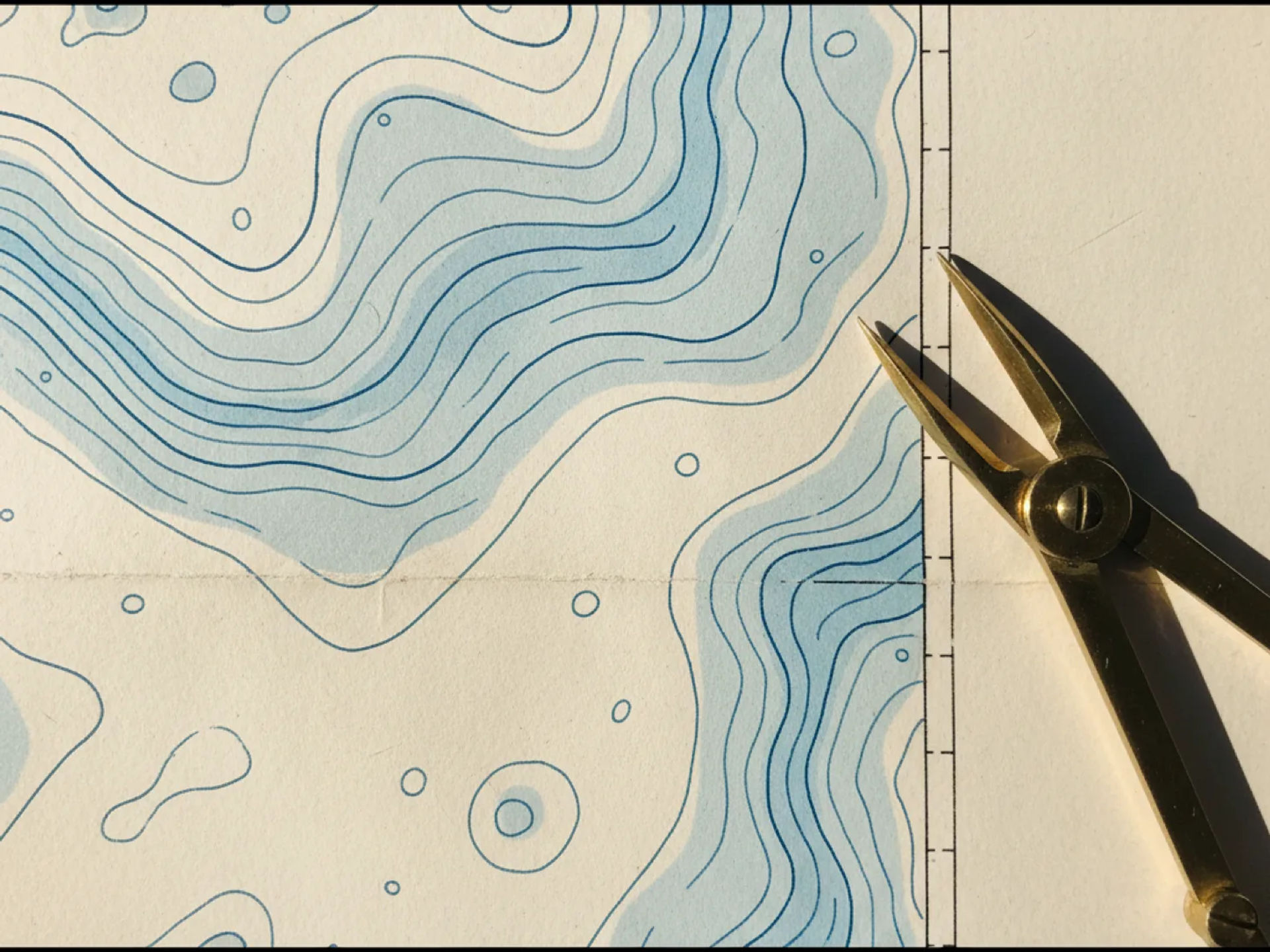
Depth contour lines connect points of equal charted water depth, providing a visual representation of the underwater landscape.
These lines help sailors identify areas where the seafloor gradually slopes or changes depth more sharply.
For example:
- Closely spaced contour lines: Often indicate a relatively steep underwater slope.
- Widely spaced contour lines: Generally suggest a more gradual change in depth.
- Shallow contour areas: May identify potential grounding hazards for deeper-draft vessels.
- Deeper channels: Can provide navigable routes through otherwise shallow areas.
Understanding contour lines is especially important when navigating coastal waters, entering unfamiliar harbors, or selecting an anchorage.
How Tides Affect Charted Water Depths
A nautical chart typically displays water depths relative to a specific reference level called chart datum. In many U.S. coastal waters, this reference is Mean Lower Low Water (MLLW).
Actual water depth changes as tides rise and fall.
For example, if a chart shows a depth of 8 feet and the predicted tide height is 3 feet above chart datum, the estimated water depth would be approximately 11 feet, assuming local conditions match the prediction.
However, wind, atmospheric pressure, waves, and other environmental conditions may cause actual water levels to differ from predictions.
Sailors must also consider their vessel’s draft and maintain an appropriate under-keel clearance when evaluating whether an area is safe to navigate.
How to Identify Buoys and Navigation Markers on Nautical Charts
Navigation markers are essential tools for guiding vessels through channels, identifying hazards, and maintaining safe passage.
In U.S. coastal waters, the lateral buoyage system generally follows the IALA Region B convention.
Red and Green Channel Markers
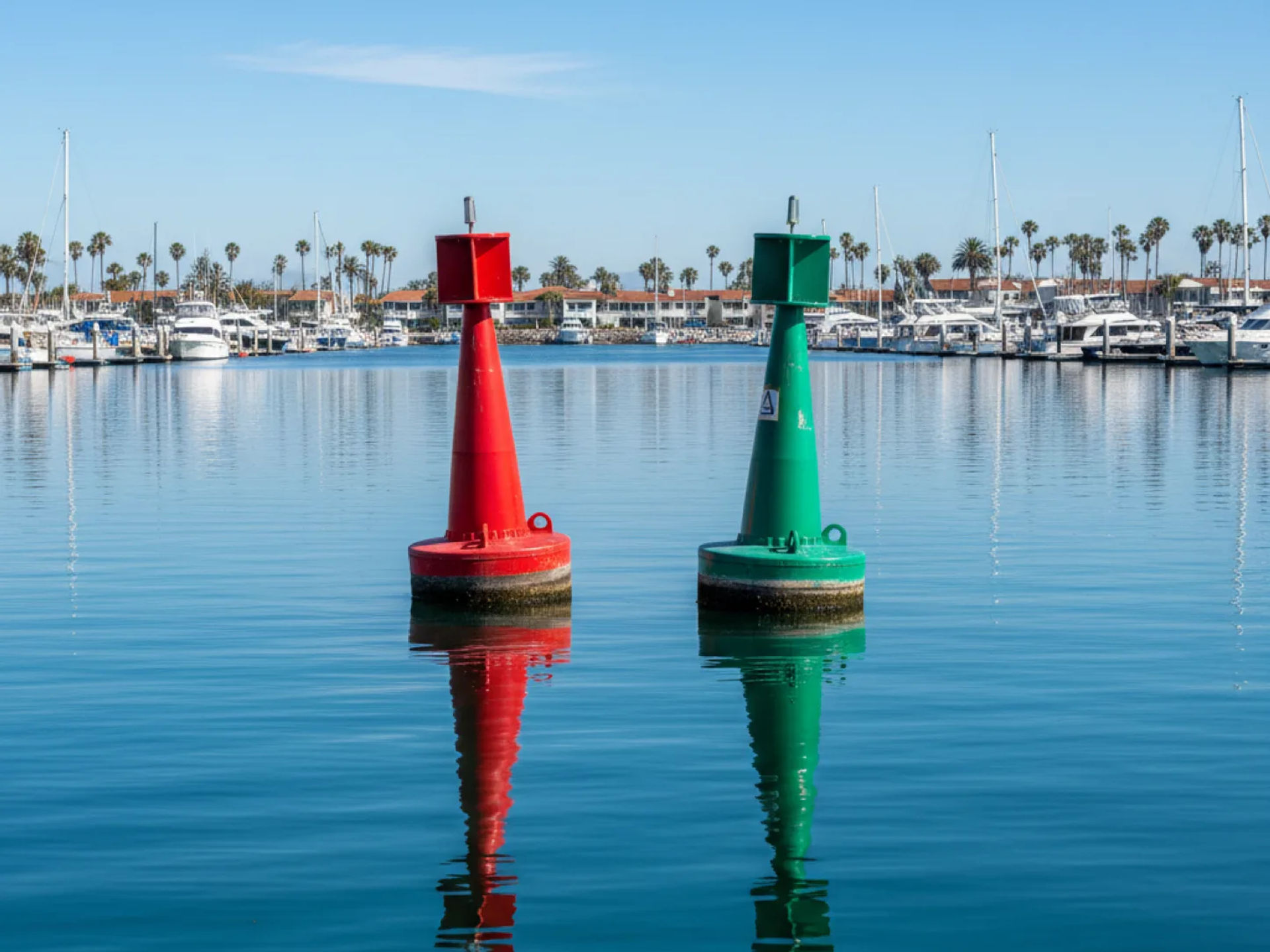
Red and green navigation markers identify the sides of designated waterways and channels.
A common navigation phrase is "Red, Right, Returning."
This means that when entering a harbor from the sea or traveling in the conventional direction of buoyage, boaters should generally keep red lateral markers on the starboard, or right, side of the vessel.
Green lateral markers are generally kept on the port, or left, side when returning from sea.
These markers commonly have distinguishing characteristics:
- Red markers: Typically display even numbers and may be shaped like a cone or nun buoy.
- Green markers: Typically display odd numbers and may be shaped like a cylinder or can buoy.
- Lighted markers: Use recognizable flashing patterns to assist with identification in darkness or reduced visibility.
Always confirm the applicable direction of buoyage and consult local navigation information, as channel arrangements and special situations can vary.
Safe Water Markers
Safe water markers generally feature red and white vertical stripes.
They indicate navigable water around the marker and are sometimes used to identify fairways, mid-channel locations, or approaches to harbors.
However, they do not guarantee that every surrounding area has sufficient depth for every vessel.
Hazard and Special-Purpose Markers
Additional navigation aids identify isolated dangers, restricted areas, and locations designated for specific maritime activities.
Examples include:
- Isolated danger marks: Identify a particular hazard with navigable water surrounding it.
- Special marks: Often yellow and used to identify designated areas, activities, or features.
- Regulatory markers: Communicate boating restrictions, warnings, or other local regulations.
Learning to distinguish these markers helps sailors interpret navigational instructions and avoid potentially hazardous areas.
Learn How to Read Nautical Charts With Naos Yachts in Marina del Rey
At Naos Yachts, we believe that confident sailing begins with a strong understanding of navigation, seamanship, and practical boat-handling skills. Located in Marina del Rey, California, we offer a comprehensive selection of American Sailing and American Boating certified classes designed for everyone from first-time sailors to experienced boaters seeking advanced training. Our sailing school emphasizes practical instruction and the knowledge needed to navigate coastal waters safely, operate sailing vessels, and prepare for more challenging adventures.
For sailors looking to expand their navigation capabilities, we offer Advanced Sailing & Coastal Navigation (ASA 105 & ASA 106). Our advanced three-day course combines coastal navigation principles with advanced cruising and seamanship techniques. ASA 105 focuses on nautical chart interpretation, course plotting, tides, currents, and position fixing, while ASA 106 builds on these fundamentals with advanced coastal cruising skills for sailing vessels approximately 30 to 50 feet in length. Students explore subjects such as heavy-weather seamanship, advanced sail handling, vessel stability, emergency procedures, anchoring techniques, engine troubleshooting, and nighttime man-overboard drills. Prerequisites include ASA 101, ASA 103, and ASA 104, providing students with the foundational experience needed for advanced instruction.
Build Your Navigation Skills and Sail With Confidence at Naos Yachts
Learning how to read a nautical chart is an important step toward becoming a more knowledgeable and independent sailor. By understanding nautical chart symbols, depth measurements, navigation markers, and route-planning techniques, you can better anticipate potential hazards and make informed decisions while navigating coastal waters.
At Naos Yachts, we’re here to help you turn that foundational knowledge into practical sailing experience. Whether you’re looking to strengthen your coastal navigation skills, pursue advanced cruising certifications, or prepare for more challenging passages, our sailing school in Marina del Rey offers professional instruction to help you work toward your goals.
Ready to take your navigation and sailing skills to the next level? Contact Naos Yachts to learn more about our sailing courses, or book our ASA 105 & ASA 106 Advanced Sailing & Coastal Navigation course online and take the next step toward becoming a more confident and capable sailor.
FAQs
What do the numbers on a nautical chart mean?
The numbers on a nautical chart typically represent water depths, also known as soundings, measured in feet, meters, or fathoms. These measurements help sailors identify shallow areas, determine safe passages, and avoid underwater hazards.
What are the most important symbols on a nautical chart?
Some of the most important nautical chart symbols identify rocks, reefs, shipwrecks, navigation buoys, lighthouses, and underwater obstructions. Understanding these symbols helps boaters recognize potential hazards and safely navigate unfamiliar waterways.
What do the colors on a nautical chart mean?
Colors on nautical charts help distinguish land, water depths, intertidal areas, and other important navigational features. For example, blue shading often indicates relatively shallow water on traditional charts, while white areas generally represent deeper water, although specific color conventions depend on the chart.
How do you measure distance on a nautical chart?
Distances on nautical charts are typically measured in nautical miles using the chart’s latitude scale. One nautical mile equals approximately 1.15 statute miles, making it the standard unit for measuring maritime distances and calculating travel times.